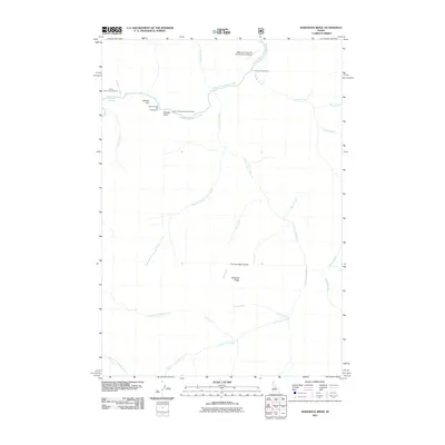
2011 Map of Sliderock Ridge
USGS Topo · Published 2011About this map
The Middle Fork Salmon River carves through this remote Idaho landscape, serving as the primary corridor for backcountry access and recreation. Near its banks, the Mahoney Creek-US Forest Service Airport provides a critical landing strip for this roadless area, while Cougar Creek Ranch represents one of the few named private landmarks in the vicinity. The map documents a geography defined by its dramatic tributary system, including Little Loon Creek and its many branches like West Fork Little Loon Creek and Corley Creek. Recreation is central to the area's current use, with several sites dedicated to public access, such as Hood Ranch Campground, Upper Jackass Flat Campground, and the nearby Sunflower Hot Springs. Geologic and local identifiers like Sliderock Ridge, Jackass Gulch, and the uniquely named Fred and Mary Draw offer insights into the naming conventions used by early settlers and forest rangers.
Find a feature on this map
27 named features on this map. Tap any name to fly to it.
Don’t see what you’re looking for? This feature index may not catch every label — zoom into the map to look around manually.
Map Details
Editions of this 2011 Sliderock Ridge Map
This is the sole edition of this map. No revisions or reprints were ever made.
Other maps of this area

1930 · Casto
USGS Topo · 1:125,000

1957 · Challis
USGS Topo · 1:250,000

1960 · Challis
USGS Topo · 1:250,000

1961 · Greyhound Ridge
USGS Topo · 1:62,500

1962 · Norton Ridge
USGS Topo · 1:24,000

1962 · Ramey Hill
USGS Topo · 1:24,000

1963 · Challis
USGS Topo · 1:250,000

1963 · Pinyon Peak
USGS Topo · 1:24,000

1963 · Casto
USGS Topo · 1:24,000
1963 · Sliderock Ridge
USGS Topo · 1:24,000