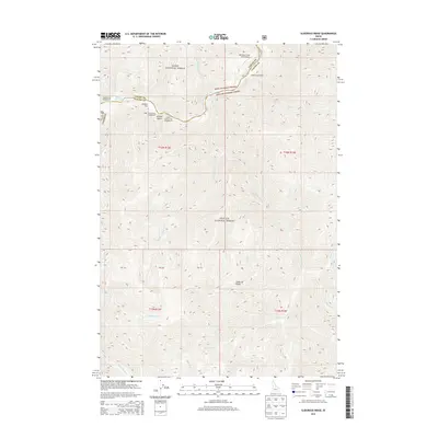
2013 Map of Sliderock Ridge
USGS Topo · Published 2013About this map
Sunflower Hot Springs sits along the Middle Fork Salmon River, highlighting the geothermal and hydrologic character of this mountain landscape. The area is defined by the meeting of the Boise National Forest and Challis National Forest, where steep drainages like Jackass Gulch and Slide Cr descend from the namesake Sliderock Ridge. Human activity is concentrated along the river corridor and its tributaries, evidenced by the Mahoney Creek USFS Airport and local landmarks such as Cougar Creek Ranch. Remote camping facilities, including Upper Jackass Flat Campground and Hood Ranch Campground, provide access to the various forks of Little Loon Cr and N Fork Sheep Cr, documenting the modern recreational footprint within these expansive national forest boundaries.
Find a feature on this map
37 named features on this map. Tap any name to fly to it.
Don’t see what you’re looking for? This feature index may not catch every label — zoom into the map to look around manually.
Map Details
Editions of this 2013 Sliderock Ridge Map
This is the sole edition of this map. No revisions or reprints were ever made.
Other maps of this area

1930 · Casto
USGS Topo · 1:125,000

1957 · Challis
USGS Topo · 1:250,000

1960 · Challis
USGS Topo · 1:250,000

1961 · Greyhound Ridge
USGS Topo · 1:62,500

1962 · Norton Ridge
USGS Topo · 1:24,000

1962 · Ramey Hill
USGS Topo · 1:24,000

1963 · Challis
USGS Topo · 1:250,000

1963 · Pinyon Peak
USGS Topo · 1:24,000

1963 · Casto
USGS Topo · 1:24,000
1963 · Sliderock Ridge
USGS Topo · 1:24,000