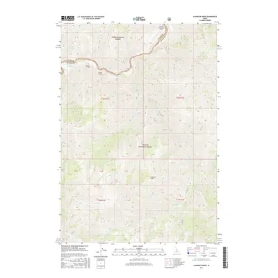
2017 Map of Sliderock Ridge
USGS Topo · Published 2017About this map
The Middle Fork Salmon River carves through this remote interior of Idaho, serving as a natural boundary between Boise National Forest and Challis National Forest. The map details a landscape where water and elevation dictate the terrain's character, from the high points of Sliderock Ridge to the deep drainage of Little Loon Cr. This 2017 survey reflects the area's role as a wilderness and recreation hub, specifically highlighting the Sunflower Hot Springs along the riverbank and the Mahoney Creek USFS Airport tucked into the northern canyons. Historical and geographic markers like Jackass Flat and Jackass Gulch appear alongside an intricate network of waterways, including N Fork Sheep Cr and Blue Lake, showing the primitive state of the backcountry in the 21st century.
Find a feature on this map
32 named features on this map. Tap any name to fly to it.
Don’t see what you’re looking for? This feature index may not catch every label — zoom into the map to look around manually.
Map Details
Editions of this 2017 Sliderock Ridge Map
This is the sole edition of this map. No revisions or reprints were ever made.
Other maps of this area

1930 · Casto
USGS Topo · 1:125,000

1957 · Challis
USGS Topo · 1:250,000

1960 · Challis
USGS Topo · 1:250,000

1961 · Greyhound Ridge
USGS Topo · 1:62,500

1962 · Norton Ridge
USGS Topo · 1:24,000

1962 · Ramey Hill
USGS Topo · 1:24,000

1963 · Challis
USGS Topo · 1:250,000

1963 · Pinyon Peak
USGS Topo · 1:24,000

1963 · Casto
USGS Topo · 1:24,000
1963 · Sliderock Ridge
USGS Topo · 1:24,000