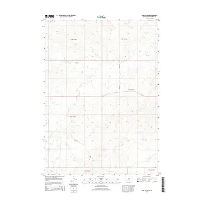
2015 Map of Slim Butte NW
USGS Topo · Published 2015About this map
The rolling plains of Oglala Lakota County are defined by the intricate drainage systems of the Blacktail Cr and its southern branch, the S Br Blacktail Cr. In this portion of the Pine Ridge region, the landscape is segmented by the Public Land Survey System, with the map recording the intersections of Townships 36, 37, and 38 North. Essential transportation corridors such as Bia-52 and Hagmans Rd provide the primary access through this rangeland, while Slim Buttes Rd skirts the southern reaches of the map near Slim Butte Cr. The absence of dense town clusters highlights the vast, open-space character of the area in 2015, where the primary human impact is visible through the network of tribal and local roads connecting scattered homesteads or lease lands.
Find a feature on this map
12 named features on this map. Tap any name to fly to it.
Don’t see what you’re looking for? This feature index may not catch every label — zoom into the map to look around manually.
Map Details
Editions of this 2015 Slim Butte NW Map
This is the sole edition of this map. No revisions or reprints were ever made.
Other maps of this area

1896 · Oelrichs
USGS Topo · 1:125,000

1900 · Oelrichs
USGS Topo · 1:125,000

1955 · Hot Springs
USGS Topo · 1:250,000

1967 · Slim Butte SW
USGS Topo · 1:24,000

1967 · Slim Butte NW
USGS Topo · 1:24,000

1967 · Slim Butte NE
USGS Topo · 1:24,000

1967 · Slim Butte
USGS Topo · 1:24,000

1967 · Willow Creek SW
USGS Topo · 1:24,000

1967 · Willow Creek
USGS Topo · 1:24,000
1982 · Heinne Creek
USGS Topo · 1:25,000