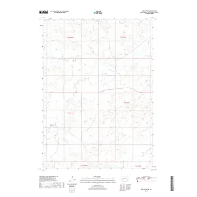
2017 Map of Slim Butte NW
USGS Topo · Published 2017About this map
Swallow Church Cem stands as a focal point of this rural terrain in Oglala Lakota County, located near the headwaters of S Br Blacktail Cr. The landscape is defined by the intricate drainages of Blacktail Cr and Slim Butte Cr, which carve through the high plains of the Pine Ridge area. Transportation in this section of the reservation is limited to local routes such as Bia Rd 52, which winds through the northern sections of the survey. The mapping reveals a sparse settlement pattern dominated by topographic contours and township boundaries, reflecting the remote nature of the western South Dakota plains. Genealogists and historians will find the specific placement of the church and cemetery significant for identifying early community centers in this portion of the t37n r48w and t38n r48w townships.
Find a feature on this map
12 named features on this map. Tap any name to fly to it.
Don’t see what you’re looking for? This feature index may not catch every label — zoom into the map to look around manually.
Map Details
Editions of this 2017 Slim Butte NW Map
This is the sole edition of this map. No revisions or reprints were ever made.
Other maps of this area

1896 · Oelrichs
USGS Topo · 1:125,000

1900 · Oelrichs
USGS Topo · 1:125,000

1955 · Hot Springs
USGS Topo · 1:250,000

1967 · Slim Butte SW
USGS Topo · 1:24,000

1967 · Slim Butte NW
USGS Topo · 1:24,000

1967 · Slim Butte NE
USGS Topo · 1:24,000

1967 · Slim Butte
USGS Topo · 1:24,000

1967 · Willow Creek SW
USGS Topo · 1:24,000

1967 · Willow Creek
USGS Topo · 1:24,000
1982 · Heinne Creek
USGS Topo · 1:25,000