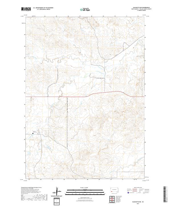
2021 Map of Slim Butte NW
USGS Topo · Published 2021About this map
Swallow Church Cem stands as a focal point for local history in this portion of South Dakota within the Oglala Lakota territory. The landscape is defined by the branching drainage systems of Blacktail Creek, including the South Branch Blacktail Creek which cuts through the northern sections, and Slim Butte Creek to the south. Transportation in the area is largely facilitated by BIA Road 52, reflecting the infrastructure of the tribal land management system. The map provides a look at the Public Land Survey System organization, spanning several townships including t37n r48w and t38n r47w. The absence of dense residential development emphasizes the area's rural character, where small landmarks and watercourses dictate the geography of the community.
Find a feature on this map
12 named features on this map. Tap any name to fly to it.
Don’t see what you’re looking for? This feature index may not catch every label — zoom into the map to look around manually.
Map Details
Editions of this 2021 Slim Butte NW Map
This is the sole edition of this map. No revisions or reprints were ever made.
Other maps of this area

1896 · Oelrichs
USGS Topo · 1:125,000

1900 · Oelrichs
USGS Topo · 1:125,000

1955 · Hot Springs
USGS Topo · 1:250,000

1967 · Slim Butte SW
USGS Topo · 1:24,000

1967 · Slim Butte NW
USGS Topo · 1:24,000

1967 · Slim Butte NE
USGS Topo · 1:24,000

1967 · Slim Butte
USGS Topo · 1:24,000

1967 · Willow Creek SW
USGS Topo · 1:24,000

1967 · Willow Creek
USGS Topo · 1:24,000
1982 · Heinne Creek
USGS Topo · 1:25,000