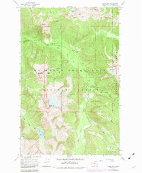
1966 Map of Sloan Peak
USGS Topo · Published 1982About this map
Sloan Peak and Bedal Peak dominate this high-altitude landscape within the Mt Baker - Snoqualmie National Forest, reflecting the complex topography of the Cascades during the mid-1960s. The drainage systems are well-defined, with the North Fork Sauk River joined by high-elevation tributaries such as Ruby Creek, Garnet Creek, and Bedal Creek. Remote mountain lakes including Goat Lake, Cadet Lake, and Round Lake dot the terrain, while the Glacier Peak Wilderness boundary marks the eastern reaches of the sheet.
Find a feature on this map
35 named features on this map. Tap any name to fly to it.
Don’t see what you’re looking for? This feature index may not catch every label — zoom into the map to look around manually.
Map Details
Editions of this 1966 Sloan Peak Map
4 editions found
Other maps of this area

1899 · Glacier Peak
USGS Topo · 1:125,000

1901 · Glacier Peak
USGS Topo · 1:125,000

1902 · Skykomish
USGS Topo · 1:125,000

1905 · Skykomish
USGS Topo · 1:125,000

1950 · Glacier Peak
USGS Topo · 1:62,500

1955 · Concrete
USGS Topo · 1:250,000

1957 · Wenatchee
USGS Topo · 1:250,000

1958 · Concrete
USGS Topo · 1:250,000

1962 · Concrete
USGS Topo · 1:250,000

1965 · Monte Cristo
USGS Topo · 1:24,000