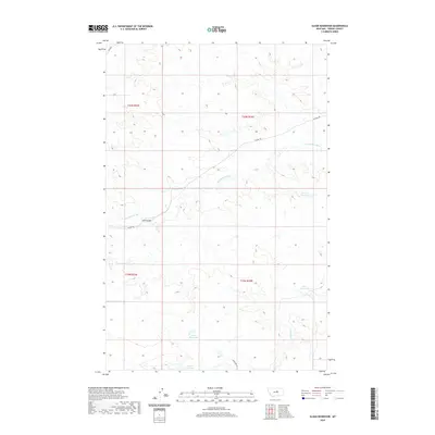
2020 Map of Sloan Reservoir
USGS Topo · Published 2020About this map
The Sacagawea River winds through this expanse of Fergus County, defining a landscape dominated by water management and high-plains drainage. This remote region is characterized by a series of significant catchments, including Sloan Reservoir and Lincoln Reservoir to the south, and Jordan Reservoir and Kosier Reservoir to the east. These features, along with Antelope Cr, suggest a land utilized for ranching or irrigation where water security is paramount. Human infrastructure is concentrated around crossings and tracks, most notably at Joslin Bridge. The area is navigated via established routes like Ridge Rd and the Wilder Trl, which follow the contours of the terrain rather than a strict grid, reflecting the practical necessities of travel in central Montana's open country.
Find a feature on this map
14 named features on this map. Tap any name to fly to it.
Don’t see what you’re looking for? This feature index may not catch every label — zoom into the map to look around manually.
Map Details
Editions of this 2020 Sloan Reservoir Map
This is the sole edition of this map. No revisions or reprints were ever made.
Other maps of this area

1943 · Landusky
USGS Topo · 1:125,000

1954 · Hessler Ridge
USGS Topo · 1:24,000

1954 · Carter Coulee
USGS Topo · 1:24,000

1954 · Lewistown
USGS Topo · 1:250,000

1959 · Lewistown
USGS Topo · 1:250,000

1984 · Zortman
USGS Topo · 1:100,000

1985 · Griffee Coulee
USGS Topo · 1:24,000

1985 · Bear Creek Reservoir SE
USGS Topo · 1:24,000

1985 · Sloan Reservoir
USGS Topo · 1:24,000
1985 · Mitchell Crossing
USGS Topo · 1:24,000