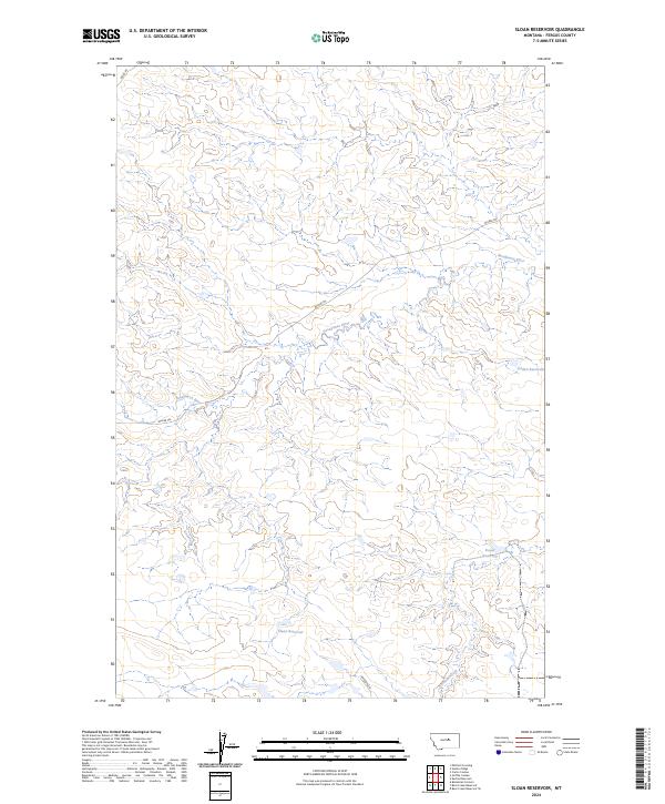
2024 Map of Sloan Reservoir
USGS Topo · Published 2024About this map
Sacagawea River winds across this Fergus County landscape, defining the local hydrography as it flows through the western and central sections of the survey. The region is characterized by its network of water management features, including the prominent Sloan Reservoir in the south and the smaller Jordan Reservoir and Kosier Reservoir to the east. These catchments, along with Antelope Creek, suggest a rural environment where water security is vital for land use. The transportation network is sparse, primarily consisting of the long-reaching Wilder Trl and localized routes like Ridge Rd and Antelope Ln. The map clearly delineates the township and range boundaries of t20n r23e, t20n r24e, t19n r23e, and t19n r24e, which provide the essential legal framework for property and land management in this part of Montana.
Find a feature on this map
12 named features on this map. Tap any name to fly to it.
Don’t see what you’re looking for? This feature index may not catch every label — zoom into the map to look around manually.
Map Details
Editions of this 2024 Sloan Reservoir Map
This is the sole edition of this map. No revisions or reprints were ever made.
Other maps of this area

1943 · Landusky
USGS Topo · 1:125,000

1954 · Hessler Ridge
USGS Topo · 1:24,000

1954 · Carter Coulee
USGS Topo · 1:24,000

1954 · Lewistown
USGS Topo · 1:250,000

1959 · Lewistown
USGS Topo · 1:250,000

1984 · Zortman
USGS Topo · 1:100,000

1985 · Griffee Coulee
USGS Topo · 1:24,000

1985 · Bear Creek Reservoir SE
USGS Topo · 1:24,000

1985 · Sloan Reservoir
USGS Topo · 1:24,000
1985 · Mitchell Crossing
USGS Topo · 1:24,000