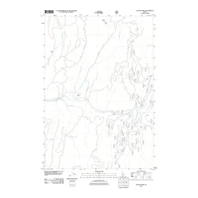
2011 Map of Sloans Point
USGS Topo · Published 2011About this map
Sloans Point Lookout crowns the high ground of this Valley County landscape, a vital vantage point overlooking the drainage basins of the Gold Fork River. The topography is defined by the convergence of mountain waters, including the North Fork Gold Fork River and South Fork Gold Fork River, which meet south of the settlement at Little Valley. This area shows a transition from high-altitude ridge lines like the Foolhen Ridge-Firetrail to the lower meadows where Flat Creek and French Creek flow. Human activity is marked by a complex network of forest access routes such as Kennally Creek Rd and Sloans Point Rd, alongside the industrial presence of Brown Dam on Laffinwell Creek. The map documents a rugged timber and watershed management area in the early 21st century, illustrating the relationship between the Sloans Point summit and the river valleys below.
Find a feature on this map
61 named features on this map. Tap any name to fly to it.
Don’t see what you’re looking for? This feature index may not catch every label — zoom into the map to look around manually.
Map Details
Editions of this 2011 Sloans Point Map
This is the sole edition of this map. No revisions or reprints were ever made.
Other maps of this area

1911 · Meadows
USGS Topo · 1:125,000

1954 · Gold Fork
USGS Topo · 1:62,500

1954 · Cascade
USGS Topo · 1:62,500

1955 · Baker
USGS Topo · 1:250,000

1957 · Challis
USGS Topo · 1:250,000

1959 · Baker
USGS Topo · 1:250,000

1960 · Challis
USGS Topo · 1:250,000

1963 · Challis
USGS Topo · 1:250,000

1973 · Blackmare
USGS Topo · 1:24,000
1973 · Paddy Flat
USGS Topo · 1:24,000