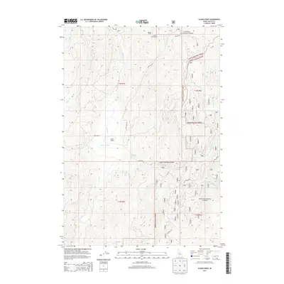
2013 Map of Sloans Point
USGS Topo · Published 2013About this map
Sloans Point Lookout watches over the high-elevation divide between the Payette National Forest and the Boise National Forest in this 2013 Idaho survey. The landscape is defined by the convergence of mountain drainages, most notably the Gold Fork River, which is joined by its northern and southern forks. In the heart of the quadrangle, Little Valley provides a rare pocket of level terrain amidst the peaks, situated near the Gold Fork Hot Spring. Transportation in this backcountry area is limited to forest routes like Sloans Point Rd and Gold Fork Rd, tracing the paths of drainages such as Rapid Cr and French Cr. This map documents the essential hydrology and forest infrastructure of the central Idaho mountains, from the headwaters of Willow Cr to the intricate network of creek beds supporting the regional watershed.
Find a feature on this map
25 named features on this map. Tap any name to fly to it.
Don’t see what you’re looking for? This feature index may not catch every label — zoom into the map to look around manually.
Map Details
Editions of this 2013 Sloans Point Map
This is the sole edition of this map. No revisions or reprints were ever made.
Other maps of this area

1911 · Meadows
USGS Topo · 1:125,000

1954 · Gold Fork
USGS Topo · 1:62,500

1954 · Cascade
USGS Topo · 1:62,500

1955 · Baker
USGS Topo · 1:250,000

1957 · Challis
USGS Topo · 1:250,000

1959 · Baker
USGS Topo · 1:250,000

1960 · Challis
USGS Topo · 1:250,000

1963 · Challis
USGS Topo · 1:250,000

1973 · Blackmare
USGS Topo · 1:24,000
1973 · Paddy Flat
USGS Topo · 1:24,000