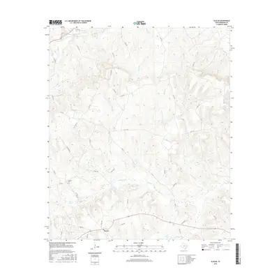
2016 Map of Slocum
USGS Topo · Published 2016About this map
Slocum serves as the primary settlement hub for this portion of Anderson County, where a intricate network of local roads such as Union Hope Rd and Slocum Pines navigate a landscape defined by its many creek branches. The terrain is deeply carved by drainage systems including Squirrel Cr, Turkey Cr, and Alder Br, all feeding toward the Ioni Marsh and Ioni Cr in the south. These watercourses have historically shaped the rural road patterns, with numerous county roads following the ridgelines between these small valleys. Genealogists will find the Crawford Cem positioned near FM 1817, while the presence of Mays Lake further highlights the area's hydrology. The map illustrates a contemporary view of this wooded and agricultural region, where modern highway designations like FM 323 intersect with long-established property-line roads.
Find a feature on this map
43 named features on this map. Tap any name to fly to it.
Don’t see what you’re looking for? This feature index may not catch every label — zoom into the map to look around manually.
Map Details
Editions of this 2016 Slocum Map
This is the sole edition of this map. No revisions or reprints were ever made.
Other maps of this area

1949 · Palestine
USGS Topo · 1:62,500

1950 · Palestine
USGS Topo · 1:62,500

1951 · Elkhart
USGS Topo · 1:62,500

1951 · Jacksonville
USGS Topo · 1:62,500

1952 · Slocum
USGS Topo · 1:62,500

1953 · Palestine
USGS Topo · 1:250,000

1957 · Palestine
USGS Topo · 1:250,000

1981 · Palestine
USGS Topo · 1:100,000
1982 · Maydelle
USGS Topo · 1:24,000
1982 · Percilla
USGS Topo · 1:24,000