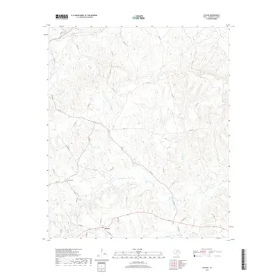
2019 Map of Slocum
USGS Topo · Published 2019About this map
Slocum serves as the primary hub for this Anderson County landscape, situated at the intersection of several farm-to-market roads and county routes. The terrain is defined by a dense network of minor waterways, including Squirrel Cr, Turkey Cr, and Alder Br, which drain toward the southeast into the Ioni Marsh and Ioni Cr. This hydrology has historically shaped the settlement patterns and road placements in the region, with routes often following the higher ground between the numerous creek beds. To the southeast, the elevated stands of Slocum Pines offer a distinct topographical contrast to the marshy lowlands nearby. Genealogists and local historians can find the Crawford Cem positioned near FM 1817, while the road network, featuring names like Union Hope Rd, reflects the community-focused infrastructure of this rural Texas landscape.
Find a feature on this map
44 named features on this map. Tap any name to fly to it.
Don’t see what you’re looking for? This feature index may not catch every label — zoom into the map to look around manually.
Map Details
Editions of this 2019 Slocum Map
This is the sole edition of this map. No revisions or reprints were ever made.
Other maps of this area

1949 · Palestine
USGS Topo · 1:62,500

1950 · Palestine
USGS Topo · 1:62,500

1951 · Elkhart
USGS Topo · 1:62,500

1951 · Jacksonville
USGS Topo · 1:62,500

1952 · Slocum
USGS Topo · 1:62,500

1953 · Palestine
USGS Topo · 1:250,000

1957 · Palestine
USGS Topo · 1:250,000

1981 · Palestine
USGS Topo · 1:100,000
1982 · Maydelle
USGS Topo · 1:24,000
1982 · Percilla
USGS Topo · 1:24,000