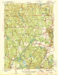
1943 Map of Slocum
USGS Topo · Published 1943About this map
Slocum and the rural townships of Exeter and West Greenwich define this wartime landscape, where the New York New Haven and Hartford Railroad cuts a straight line through the eastern valley. The map reveals a highly decentralized educational network, noting isolated schoolhouses like the Hitty Corner Sch and Chestnut Hill Sch serving small upland communities. Large tracts of wetlands and water bodies, including Yawgoo Pond and Arrow Swamp, suggest a landscape still heavily influenced by its natural drainage patterns and glacial terrain, with several small mills once powered by the Queen River and Reynolds Brook.
Find a feature on this map
69 named features on this map. Tap any name to fly to it.
Don’t see what you’re looking for? This feature index may not catch every label — zoom into the map to look around manually.
Map Details
Editions of this 1943 Slocum Map
2 editions found
Other maps of this area

1889 · Charlestown
USGS Topo · 1:62,500

1889 · Newport
USGS Topo · 1:62,500

1890 · Narragansett Bay
USGS Topo · 1:62,500

1890 · Kent
USGS Topo · 1:62,500

1892 · Narragansett Bay
USGS Topo · 1:62,500

1894 · Kent
USGS Topo · 1:62,500

1894 · Newport
USGS Topo · 1:62,500

1904 · Newport
USGS Topo · 1:62,500

1919 · Charlestown
USGS Topo · 1:62,500

1919 · Narragansett Bay
USGS Topo · 1:62,500