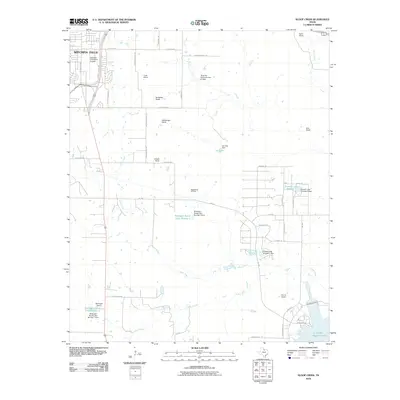
2010 Map of Sloop Creek
USGS Topo · Published 2010About this map
The southeastern outskirts of Witchita Falls transition into a landscape of large-scale cattle ranching and energy extraction in this 2010 survey. The northwestern corner is anchored by the Kickapoo Downtown Airpark, while the central terrain is defined by the Vogtsberger Oil Field, illustrating the ongoing importance of petroleum to the regional economy. Family names are deeply etched into the land, appearing on numerous properties such as Cook Ranch, Rathgeber Ranch, and McGregor Ranch.
Find a feature on this map
53 named features on this map. Tap any name to fly to it.
Don’t see what you’re looking for? This feature index may not catch every label — zoom into the map to look around manually.
Map Details
Editions of this 2010 Sloop Creek Map
This is the sole edition of this map. No revisions or reprints were ever made.
Other maps of this area

1931 · Archer City
USGS Topo · 1:62,500

1954 · Wichita Falls
USGS Topo · 1:250,000

1956 · Sloop Creek
USGS Topo · 1:24,000

1956 · Lake Wichita
USGS Topo · 1:24,000

1957 · Wichita Falls West
USGS Topo · 1:24,000

1957 · Wichita Falls East
USGS Topo · 1:62,500

1957 · Wichita Falls East
USGS Topo · 1:24,000

1957 · Wichita Falls West
USGS Topo · 1:62,500

1958 · Wichita Falls
USGS Topo · 1:250,000

1963 · Deer Creek
USGS Topo · 1:24,000