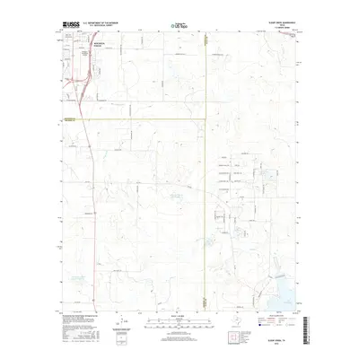
2016 Map of Sloop Creek
USGS Topo · Published 2016About this map
Kickapoo Downtown Airport and the expanding southern reaches of Wichita Falls dominate the northwestern corner of this Texas landscape. This survey reveals a transition from urban infrastructure to a rural mosaic of ranches and small private reservoirs. Local water management is evident in the numbering of McGregor Ranch Lake Number 1 and McGregor Ranch Lake Number 2, along with several other ponds and lakes that feed into Sloop Creek and Lake Cr. To the east, a dense network of trail-named roads like Sitting Bull Trl and War Path suggests localized residential development or recreation areas near B and P Lake Number 2. In the far southeast, the shoreline of Lake Arrowhead appears, marking a significant hydrological feature for the tri-county region where Archer, Clay, and Wichita counties meet.
Find a feature on this map
51 named features on this map. Tap any name to fly to it.
Don’t see what you’re looking for? This feature index may not catch every label — zoom into the map to look around manually.
Map Details
Editions of this 2016 Sloop Creek Map
This is the sole edition of this map. No revisions or reprints were ever made.
Other maps of this area

1931 · Archer City
USGS Topo · 1:62,500

1954 · Wichita Falls
USGS Topo · 1:250,000

1956 · Sloop Creek
USGS Topo · 1:24,000

1956 · Lake Wichita
USGS Topo · 1:24,000

1957 · Wichita Falls West
USGS Topo · 1:24,000

1957 · Wichita Falls East
USGS Topo · 1:62,500

1957 · Wichita Falls East
USGS Topo · 1:24,000

1957 · Wichita Falls West
USGS Topo · 1:62,500

1958 · Wichita Falls
USGS Topo · 1:250,000

1963 · Deer Creek
USGS Topo · 1:24,000