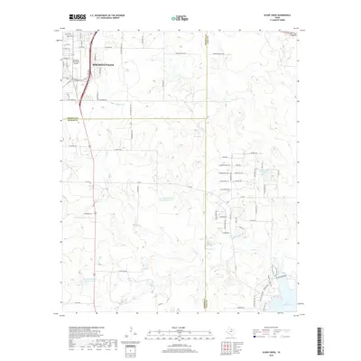
2019 Map of Sloop Creek
USGS Topo · Published 2019About this map
Wichita Falls expands into the ranching country of North Texas in this modern survey, where urban infrastructure meets established agricultural holdings. The Kickapoo Downtown Airport serves as a prominent landmark on the edge of the city, while the Henry S Grace Fwy and Windthorst Rd facilitate movement through the landscape. The geography is defined by a series of private water features and ranching developments, including McGregor Ranch Lake Number 2 and McGregor Ranch Lake Number 1. This area transitions from the residential streets of Wichita Falls in the northwest to the more open terrain of Wichita and Archer Counties. The hydrology of Sloop Cr and Lake Cr drains toward the southeast corner, eventually reaching the significant shoreline of Lake Arrowhead, highlighting the region's managed water resources.
Find a feature on this map
76 named features on this map. Tap any name to fly to it.
Don’t see what you’re looking for? This feature index may not catch every label — zoom into the map to look around manually.
Map Details
Editions of this 2019 Sloop Creek Map
This is the sole edition of this map. No revisions or reprints were ever made.
Other maps of this area

1931 · Archer City
USGS Topo · 1:62,500

1954 · Wichita Falls
USGS Topo · 1:250,000

1956 · Sloop Creek
USGS Topo · 1:24,000

1956 · Lake Wichita
USGS Topo · 1:24,000

1957 · Wichita Falls West
USGS Topo · 1:24,000

1957 · Wichita Falls East
USGS Topo · 1:62,500

1957 · Wichita Falls East
USGS Topo · 1:24,000

1957 · Wichita Falls West
USGS Topo · 1:62,500

1958 · Wichita Falls
USGS Topo · 1:250,000

1963 · Deer Creek
USGS Topo · 1:24,000