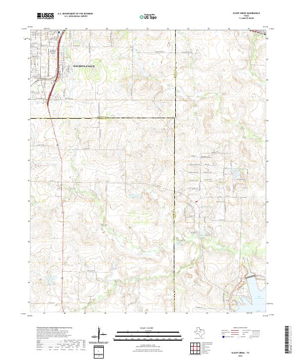
2022 Map of Sloop Creek
USGS Topo · Published 2022About this map
The southeastern edge of Wichita Falls transitions into the cattle ranching and reservoir-dotted landscape of Archer and Clay counties in this 2022 survey. The urban-rural boundary is sharply defined by the presence of Kickapoo Downtown Airport and the commercial corridor along US Highway 281. Further south and east, the map reveals a complex system of private water management and drainage, with numerous ranch-owned bodies of water such as McGregor Ranch Lake Number 1 and McGregor Ranch Lake Number 2. These features, along with Sloop Cr and Lake Cr, provide critical irrigation and livestock water for the sprawling agricultural operations. The eastern edge of the quadrangle touches the northwestern shoreline of Lake Arrowhead, a significant regional reservoir that dictates the local topography and road networks, including FM 1954.
Find a feature on this map
78 named features on this map. Tap any name to fly to it.
Don’t see what you’re looking for? This feature index may not catch every label — zoom into the map to look around manually.
Map Details
Editions of this 2022 Sloop Creek Map
This is the sole edition of this map. No revisions or reprints were ever made.
Other maps of this area

1931 · Archer City
USGS Topo · 1:62,500

1954 · Wichita Falls
USGS Topo · 1:250,000

1956 · Sloop Creek
USGS Topo · 1:24,000

1956 · Lake Wichita
USGS Topo · 1:24,000

1957 · Wichita Falls West
USGS Topo · 1:24,000

1957 · Wichita Falls East
USGS Topo · 1:62,500

1957 · Wichita Falls East
USGS Topo · 1:24,000

1957 · Wichita Falls West
USGS Topo · 1:62,500

1958 · Wichita Falls
USGS Topo · 1:250,000

1963 · Deer Creek
USGS Topo · 1:24,000