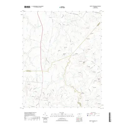
2019 Map of Smartt Mountain
USGS Topo · Published 2019About this map
Hitchcox serves as a focal point for this section of the Cumberland Plateau, where three counties—Van Buren, Bledsoe, and Sequatchie—converge. The landscape is defined by the Tennessee Valley Divide, a significant geographic boundary that separates the drainage basins of the region. High-elevation landmarks like Smartt Mtn, Hitchcox Mtn, and Black Mtn rise above a complex network of streams including Glady Fork and the Rocky River. For researchers of local heritage, the map identifies several rural burial grounds such as Hitchcox Cem, Walling Cem, and Miller Cem. The terrain is characterized by specialized landforms like The Narrows and Whiteoak Swamps, alongside local landmarks like Jordan Rock House. Transportation is dominated by the corridor of Old State Hwy 111 and the modern Archie Rhinehart Pkwy, which cut through the ridges and hollows.
Find a feature on this map
92 named features on this map. Tap any name to fly to it.
Don’t see what you’re looking for? This feature index may not catch every label — zoom into the map to look around manually.
Map Details
Editions of this 2019 Smartt Mountain Map
This is the sole edition of this map. No revisions or reprints were ever made.
Other maps of this area

1888 · Chattanooga
USGS Topo · 1:125,000

1892 · Pikeville
USGS Topo · 1:125,000

1893 · Mc Minnville
USGS Topo · 1:125,000

1893 · Chattanooga
USGS Topo · 1:125,000

1895 · Mc Minnville
USGS Topo · 1:125,000

1895 · Sewanee
USGS Topo · 1:125,000

1895 · Pikeville
USGS Topo · 1:125,000

1935 · Brockdell
USGS Topo · 1:24,000

1935 · Mount Airy
USGS Topo · 1:24,000

1935 · Smart Mountain
USGS Topo · 1:24,000