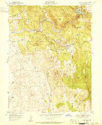
1951 Map of Smartville
USGS Topo · Published 1951About this map
Smartville stands at the center of this 1951 survey, a landscape deeply altered by the legacy of California gold mining. The winding Yuba River is flanked by extensive mounds of Tailings and historic hydraulic mining sites like the Blue Point Mine. Remnants of earlier settlement patterns are evident at the Timbuctoo (Site) and Parks Bar (Site), which were once major mining camps. Water management for industrial and agricultural use is a dominant theme, illustrated by the presence of China Ditch and the Englebright Reservoir to the northeast.
Find a feature on this map
59 named features on this map. Tap any name to fly to it.
Don’t see what you’re looking for? This feature index may not catch every label — zoom into the map to look around manually.
Map Details
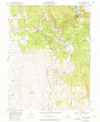
Editions of this 1951 Smartville Map
2 editions found
Other maps of this area

1888 · Smartsville
USGS Topo · 1:125,000

1891 · Smartsville
USGS Topo · 1:125,000

1892 · Smartsville
USGS Topo · 1:125,000

1894 · Smartsville
USGS Topo · 1:125,000

1895 · Smartsville
USGS Topo · 1:125,000

1910 · Wheatland
USGS Topo · 1:31,680

1911 · Browns Valley
USGS Topo · 1:31,680
1912 · Prairie Creek
USGS Topo · 1:31,680

1915 · Spenceville
USGS Topo · 1:31,680

1941 · Bangor
USGS Topo · 1:62,500