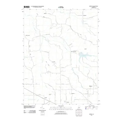
2010 Map of Smedley
USGS Topo · Published 2010About this map
Old Smedley Cemetery and New Philadelphia Cemetery lie within a rural Indiana landscape defined by its complex drainage network and elevated ridgelines. The area is anchored by small rural centers like Smedley, Prowsville, and Hitchcock, which reflect the region's agricultural character at the start of the 21st century. The topography is shaped by the transition from the North Fork Lost River in the south to prominent heights like Fleener Ridge and Mount Carmel Ridge in the northwest. Water features are central to the terrain, including Rush Creek and the man-made John Hays Lake. This survey illustrates how the local road system, including W Smedley Rd and N Highland Rd, navigates the natural valleys and hollows such as Prow Hollow to connect these dispersed settlements and historical burial grounds.
Find a feature on this map
62 named features on this map. Tap any name to fly to it.
Don’t see what you’re looking for? This feature index may not catch every label — zoom into the map to look around manually.
Map Details
Editions of this 2010 Smedley Map
This is the sole edition of this map. No revisions or reprints were ever made.
Other maps of this area

1934 · Bedford
USGS Topo · 1:48,000

1937 · Bedford
USGS Topo · 1:62,500

1950 · Salem
USGS Topo · 1:24,000

1950 · Becks Mill
USGS Topo · 1:24,000

1951 · Smedley
USGS Topo · 1:24,000

1953 · Kossuth
USGS Topo · 1:24,000

1956 · Vincennes
USGS Topo · 1:250,000

1957 · Vincennes
USGS Topo · 1:250,000

1957 · Campbellsburg
USGS Topo · 1:24,000

1957 · Livonia
USGS Topo · 1:24,000