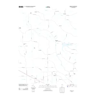
2013 Map of Smedley
USGS Topo · Published 2013About this map
The Lost River and its N Fork Lost River tributaries define the lower portion of this landscape, where the settlement of Smedley sits near the crossing of local rail and road corridors. This 2013 survey of Washington County illustrates a predominantly rural and agricultural pattern, characterized by family-named landmarks and ridge-top settlements like McKinley and Haleysbury to the north. Elevated terrain such as Fleener Ridge and Walnut Ridge separate the various creek valleys, including the drainages of Buffalo Cr and Rush Cr. The area around Rush Creek Valley and John Hays Lake shows a network of local routes like W Enon Church Rd and N Rush Creek Rd, which connect small communities such as Prowsville and Hitchcock. The presence of industrial and agricultural sites, including Stone Poultry Farms and the Washington County Landfill, provides insight into the modern land use of this southern Indiana region.
Find a feature on this map
77 named features on this map. Tap any name to fly to it.
Don’t see what you’re looking for? This feature index may not catch every label — zoom into the map to look around manually.
Map Details
Editions of this 2013 Smedley Map
This is the sole edition of this map. No revisions or reprints were ever made.
Other maps of this area

1934 · Bedford
USGS Topo · 1:48,000

1937 · Bedford
USGS Topo · 1:62,500

1950 · Salem
USGS Topo · 1:24,000

1950 · Becks Mill
USGS Topo · 1:24,000

1951 · Smedley
USGS Topo · 1:24,000

1953 · Kossuth
USGS Topo · 1:24,000

1956 · Vincennes
USGS Topo · 1:250,000

1957 · Vincennes
USGS Topo · 1:250,000

1957 · Campbellsburg
USGS Topo · 1:24,000

1957 · Livonia
USGS Topo · 1:24,000