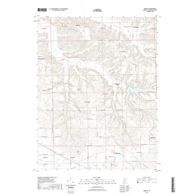
2019 Map of Smedley
USGS Topo · Published 2019About this map
The Mitchell Plain dominates the central topography of Washington County, where the subterranean drainage of the Lost River system begins to influence the landscape. This area is characterized by a transition from the dissected uplands of Fleener Ridge and Walnut Ridge down into the fertile bottomlands of the Rush Creek Valley. Small agricultural settlements like Smedley, Prowsville, and Haleysbury are connected by a network of rural routes such as W Cox Ferry Rd and N Highland Rd. The map is particularly rich for genealogical research, documenting several burial sites including the Old Smedley Cem and New Philadelphia Cem. Hydrological features like John Hays Lake and the N Fork Lost River highlight the complex water systems that have historically supported these southern Indiana farming communities.
Find a feature on this map
70 named features on this map. Tap any name to fly to it.
Don’t see what you’re looking for? This feature index may not catch every label — zoom into the map to look around manually.
Map Details
Editions of this 2019 Smedley Map
This is the sole edition of this map. No revisions or reprints were ever made.
Other maps of this area

1934 · Bedford
USGS Topo · 1:48,000

1937 · Bedford
USGS Topo · 1:62,500

1950 · Salem
USGS Topo · 1:24,000

1950 · Becks Mill
USGS Topo · 1:24,000

1951 · Smedley
USGS Topo · 1:24,000

1953 · Kossuth
USGS Topo · 1:24,000

1956 · Vincennes
USGS Topo · 1:250,000

1957 · Vincennes
USGS Topo · 1:250,000

1957 · Campbellsburg
USGS Topo · 1:24,000

1957 · Livonia
USGS Topo · 1:24,000