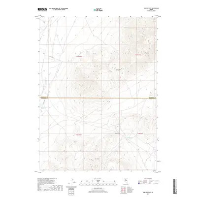
2018 Map of Smelser Pass
USGS Topo · Published 2018About this map
Smelser Pass serves as a central geographical marker in this high-elevation corner of Nevada, where the northern extent of the Tobin Range meets the southern slopes of Buffalo Mtn. This landscape is defined by its arid drainage patterns and vital water points, such as Summit Spring and the Pumpernickel Reservoir. The terrain is partitioned by the Humboldt Co / Pershing Co line, which bisects the quadrangle horizontally.
Find a feature on this map
15 named features on this map. Tap any name to fly to it.
Don’t see what you’re looking for? This feature index may not catch every label — zoom into the map to look around manually.
Map Details
Editions of this 2018 Smelser Pass Map
This is the sole edition of this map. No revisions or reprints were ever made.
Other maps of this area

1932 · Sonoma Range
USGS Topo · 1:250,000

1939 · Sonoma Range
USGS Topo · 1:250,000

1955 · Winnemucca
USGS Topo · 1:250,000

1958 · Winnemucca
USGS Topo · 1:250,000

1958 · Winnemucca
USGS Topo · 1:62,500

1961 · Leach Hot Springs
USGS Topo · 1:62,500

1962 · Winnemucca
USGS Topo · 1:250,000

1965 · Goldrun Creek
USGS Topo · 1:24,000

1965 · Edna Mountain
USGS Topo · 1:62,500
1965 · Brooks Spring
USGS Topo · 1:24,000