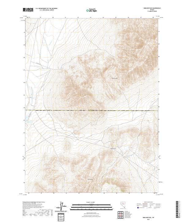
2021 Map of Smelser Pass
USGS Topo · Published 2021About this map
Smelser Pass and the high peaks of the Tobin Range define this high-desert landscape along the boundary of Humboldt and Pershing counties. In the northern reaches of the quadrangle, Buffalo Mtn rises above the drainage basins of Wilson Creek and Ragan Creek. The presence of Pumpernickel Reservoir and Summit Spring underscores the critical importance of water management and natural springs in this arid Basin and Range environment. The map details a network of rural access routes, including Spr Cross Rd and Ragan Creek Rd, which navigate the steep contour changes between the valley floors and the mountain passes. This U.S. Geological Survey representation documents the modern topography of a sparsely populated region primarily characterized by its dramatic elevation changes and essential water sources.
Find a feature on this map
14 named features on this map. Tap any name to fly to it.
Don’t see what you’re looking for? This feature index may not catch every label — zoom into the map to look around manually.
Map Details
Editions of this 2021 Smelser Pass Map
This is the sole edition of this map. No revisions or reprints were ever made.
Other maps of this area

1932 · Sonoma Range
USGS Topo · 1:250,000

1939 · Sonoma Range
USGS Topo · 1:250,000

1955 · Winnemucca
USGS Topo · 1:250,000

1958 · Winnemucca
USGS Topo · 1:250,000

1958 · Winnemucca
USGS Topo · 1:62,500

1961 · Leach Hot Springs
USGS Topo · 1:62,500

1962 · Winnemucca
USGS Topo · 1:250,000

1965 · Goldrun Creek
USGS Topo · 1:24,000

1965 · Edna Mountain
USGS Topo · 1:62,500
1965 · Brooks Spring
USGS Topo · 1:24,000