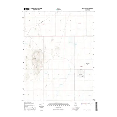
2014 Map of Smelter Knolls East
USGS Topo · Published 2014About this map
Smelter Knolls dominates the western landscape of this Millard County region, providing a significant topographic anchor in an area defined by water management and desert drainage. This 2014 survey captures the intricate irrigation and conservation network vital to the local economy, including the Abraham Canal and Abraham Reservoir in the southern sections. The map traces the historical path of the Old River Bed, which meanders northward toward the Topaz Slough and the dedicated Topaz Slough Conservation Area. This corridor reflects the intersection of natural geomorphology and human engineering, evidenced by the modern Energy Corridor Rd cutting through the northern townships. To the northwest, the Little Drum Reservoir and the Hogs Back ridge further define the arid basin's character during the early 21st century.
Find a feature on this map
22 named features on this map. Tap any name to fly to it.
Don’t see what you’re looking for? This feature index may not catch every label — zoom into the map to look around manually.
Map Details
Editions of this 2014 Smelter Knolls East Map
This is the sole edition of this map. No revisions or reprints were ever made.
Other maps of this area

1885 · Sevier Desert
USGS Topo · 1:250,000

1953 · Delta
USGS Topo · 1:250,000

1958 · Delta
USGS Topo · 1:250,000

1962 · Delta
USGS Topo · 1:250,000

1962 · Delta
USGS Topo · 1:62,500

1971 · Smelter Knolls East
USGS Topo · 1:24,000

1971 · Baker Hot Springs
USGS Topo · 1:24,000

1971 · Clay Knoll
USGS Topo · 1:24,000

1971 · Drum Mts Well
USGS Topo · 1:24,000

1971 · Fumarole Butte
USGS Topo · 1:24,000