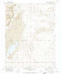
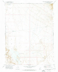
1971 Map of Baker Hot Springs
USGS Topo · Published 1974About this map
Baker Hot Springs sits at the northern edge of this arid landscape where the Juab Co and Millard Co line intersects the desert floor. The map documents a topography dominated by a vast Mud flat and the winding corridor of the Old River Bed, reflecting a time when ancient hydrologic patterns still dictated the land's character. Scattered throughout this low-lying area are several Flowing Wells and other water sources, which were critical points of interest in this otherwise parched basin. To the west, the elevation rises sharply toward the Crater Bench, providing a stark contrast to the series of large Depressions that define the central and eastern portions of the quadrangle. This 1970s survey captures the region's sparse infrastructure, noting only a solitary Gravel Pit and a few unimproved roads crossing the county boundary.
Find a feature on this map
9 named features on this map. Tap any name to fly to it.
Don’t see what you’re looking for? This feature index may not catch every label — zoom into the map to look around manually.
Map Details
Editions of this 1971 Baker Hot Springs Map
This is the sole edition of this map. No revisions or reprints were ever made.
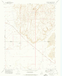
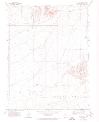
Other maps of this area

1885 · Sevier Desert
USGS Topo · 1:250,000

1953 · Delta
USGS Topo · 1:250,000

1958 · Delta
USGS Topo · 1:250,000

1962 · Delta
USGS Topo · 1:250,000
1962 · Delta
USGS Topo · 1:62,500
1971 · Smelter Knolls East
USGS Topo · 1:24,000
1971 · Rain Lake
USGS Topo · 1:24,000
1971 · Crater Bench Reservoir
USGS Topo · 1:24,000
1971 · Fumarole Butte
USGS Topo · 1:24,000
1971 · The Hogback
USGS Topo · 1:24,000