
1971 Map of Rain Lake
USGS Topo · Published 1974About this map
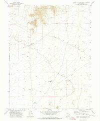
Sand Dunes dominate this arid landscape along the border of Juab and Millard counties. The area is defined by its water management and grazing history, notably at the Nooning Ground (Site), a place-name reflecting the seasonal rhythms of livestock movement in the high desert. Man-made infrastructure is critical to the region's utility, including the CCC Reservoir, a legacy of Depression-era public works, and the North Sugarville Reservoir. The presence of Delta Well No 1 and various ephemeral water sources like Rain Lake underscore the vital importance of water rights and access in this part of Utah during the early 1970s. Industrial activity is limited but present, marked by a Borrow Pit in the southern portion of the quadrangle.
Find a feature on this map
9 named features on this map. Tap any name to fly to it.
Don’t see what you’re looking for? This feature index may not catch every label — zoom into the map to look around manually.
Map Details
Editions of this 1971 Rain Lake Map
This is the sole edition of this map. No revisions or reprints were ever made.
Other maps of this area

1885 · Sevier Desert
USGS Topo · 1:250,000

1951 · Oak City
USGS Topo · 1:62,500

1953 · Delta
USGS Topo · 1:250,000

1958 · Delta
USGS Topo · 1:250,000

1962 · Delta
USGS Topo · 1:250,000

1962 · Lynndyl
USGS Topo · 1:62,500

1962 · Delta
USGS Topo · 1:62,500

1971 · Baker Hot Springs
USGS Topo · 1:24,000

1971 · Crater Bench Reservoir
USGS Topo · 1:24,000
1971 · Desert Mtn Reservoir
USGS Topo · 1:24,000