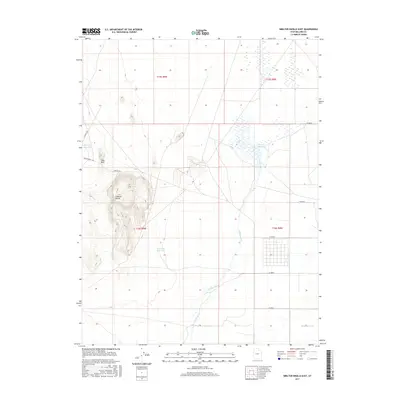
2017 Map of Smelter Knolls East
USGS Topo · Published 2017About this map
Smelter Knolls rises as a prominent landmark in this desert landscape of Millard County, defining the western terrain near Hogs Back. The hydrology of the region is centered on the remnant Old River Bed and the artificial waterways of the Abraham Canal, which feed into local irrigation and storage points like the Abraham Reservoir. To the northeast, the seasonally wet Topaz Slough indicates a shift in the drainage pattern, while industrial and access routes like Smelter Rd and I P P Maint Rd crisscross the basin. This map documents a managed water system in a land otherwise characterized by its dry basin-and-range topography, illustrating the infrastructure required to sustain the local area.
Find a feature on this map
19 named features on this map. Tap any name to fly to it.
Don’t see what you’re looking for? This feature index may not catch every label — zoom into the map to look around manually.
Map Details
Editions of this 2017 Smelter Knolls East Map
This is the sole edition of this map. No revisions or reprints were ever made.
Other maps of this area

1885 · Sevier Desert
USGS Topo · 1:250,000

1953 · Delta
USGS Topo · 1:250,000

1958 · Delta
USGS Topo · 1:250,000

1962 · Delta
USGS Topo · 1:250,000

1962 · Delta
USGS Topo · 1:62,500

1971 · Smelter Knolls East
USGS Topo · 1:24,000

1971 · Baker Hot Springs
USGS Topo · 1:24,000

1971 · Clay Knoll
USGS Topo · 1:24,000

1971 · Drum Mts Well
USGS Topo · 1:24,000

1971 · Fumarole Butte
USGS Topo · 1:24,000