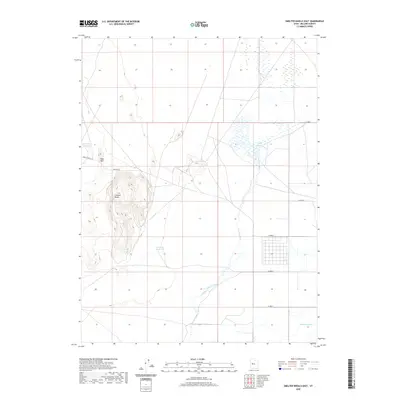
2020 Map of Smelter Knolls East
USGS Topo · Published 2020About this map
Smelter Knolls rises prominently above the surrounding basin in this western Utah landscape, providing a clear focal point for the region’s topography. The area is defined by a sparse but essential water management network, including the Abraham Reservoir, the Abraham Canal, and the Little Drum Reservoir. These features, along with the Topaz Slough to the northeast, indicate a persistent effort to direct and store water in a naturally arid environment. The presence of the Old River Bed winding through the quadrangle suggests an ancient drainage path that once shaped the valley floor. Transportation is limited to a grid of local routes like Smelter Rd and Smelter Knoll Rd, which provide access to the elevated terrain and the nearby Hogs Back. The map's layout of section lines and isolated water bodies reflects the rural, utilitarian character of Millard County land use.
Find a feature on this map
14 named features on this map. Tap any name to fly to it.
Don’t see what you’re looking for? This feature index may not catch every label — zoom into the map to look around manually.
Map Details
Editions of this 2020 Smelter Knolls East Map
This is the sole edition of this map. No revisions or reprints were ever made.
Other maps of this area

1885 · Sevier Desert
USGS Topo · 1:250,000

1953 · Delta
USGS Topo · 1:250,000

1958 · Delta
USGS Topo · 1:250,000

1962 · Delta
USGS Topo · 1:250,000

1962 · Delta
USGS Topo · 1:62,500

1971 · Smelter Knolls East
USGS Topo · 1:24,000

1971 · Baker Hot Springs
USGS Topo · 1:24,000

1971 · Clay Knoll
USGS Topo · 1:24,000

1971 · Drum Mts Well
USGS Topo · 1:24,000

1971 · Fumarole Butte
USGS Topo · 1:24,000