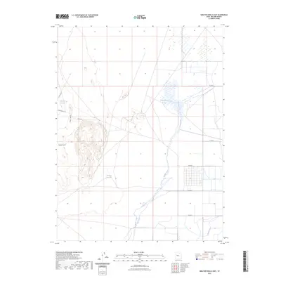
2023 Map of Smelter Knolls East
USGS Topo · Published 2023About this map
Smelter Knolls rises above the desert floor of Millard County, providing a high vantage point over a landscape defined by seasonal water and historical irrigation infrastructure. This modern survey illustrates the complex relationship between the arid terrain and the Old River Bed, which meanders through the central basin. The presence of the Abraham Canal and Abraham Reservoir indicates the ongoing efforts to manage water resources for the surrounding region, while Topaz Slough reveals the low-lying areas where water collects during periods of runoff. Further west, the Hogs Back ridgeline and the Little Drum Reservoir emphasize the isolation of this corner of the Great Salt Lake Desert, where maintenance roads like Ip P Maint RD provide the primary access for land management.
Find a feature on this map
15 named features on this map. Tap any name to fly to it.
Don’t see what you’re looking for? This feature index may not catch every label — zoom into the map to look around manually.
Map Details
Editions of this 2023 Smelter Knolls East Map
This is the sole edition of this map. No revisions or reprints were ever made.
Other maps of this area

1885 · Sevier Desert
USGS Topo · 1:250,000

1953 · Delta
USGS Topo · 1:250,000

1958 · Delta
USGS Topo · 1:250,000

1962 · Delta
USGS Topo · 1:250,000

1962 · Delta
USGS Topo · 1:62,500

1971 · Smelter Knolls East
USGS Topo · 1:24,000

1971 · Baker Hot Springs
USGS Topo · 1:24,000

1971 · Clay Knoll
USGS Topo · 1:24,000

1971 · Drum Mts Well
USGS Topo · 1:24,000

1971 · Fumarole Butte
USGS Topo · 1:24,000