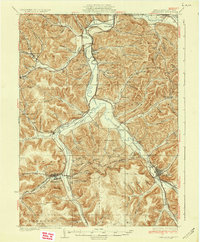
1937 Map of Smethport
USGS Topo · Published 1937About this map
Smethport and Port Allegany serve as the primary hubs in this corner of McKean County, situated at the confluence of several significant valley corridors. The Allegheny River and Potato Creek dominate the drainage pattern, their broad valleys providing the essential level ground for the region's transport network. A dense web of railroads, including the Pennsylvania and the Pittsburgh, Shawmut And Northern, follows these watercourses, illustrating the industrial connectivity of the 1930s. Away from the valley floors, the topography is characterized by numerous named hollows and hills, such as Devils Den and The Nipple. Rural life is marked by a high density of country schoolhouses like Annin Creek Sch and Newell Creek Sch, alongside local landmarks such as the St Marys Ch and a Fire Tower on a high ridge. The map also captures the transition from New York, with the state line running just north of Bullis Mills.
Find a feature on this map
117 named features on this map. Tap any name to fly to it.
Don’t see what you’re looking for? This feature index may not catch every label — zoom into the map to look around manually.
Map Details
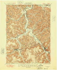
Editions of this 1937 Smethport Map
3 editions found
Other maps of this area

1898 · Olean
USGS Topo · 1:62,500

1900 · Salamanca
USGS Topo · 1:62,500

1924 · Bradford
USGS Topo · 1:62,500

1925 · Belmont
USGS Topo · 1:62,500

1926 · Bradford
USGS Topo · 1:62,500

1933 · Smethport
USGS Topo · 1:62,500

1934 · Coudersport
USGS Topo · 1:48,000

1935 · Mt. Jewett
USGS Topo · 1:48,000

1937 · Smethport
USGS Topo · 1:62,500

1938 · Coudersport
USGS Topo · 1:62,500