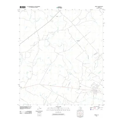
2010 Map of Smiley
USGS Topo · Published 2010About this map
Smiley serves as the primary hub for this rural stretch of Gonzales County, where the street grid of the small town is framed by agricultural roads and cattle country. The landscape is defined by the convergence of several major waterways, including Sandies Creek, Little Elm Creek, and the Clear Fork Creek. These drainage systems create a branching network of tributaries like Wickey Branch and Yow Branch that have shaped the local topography for generations.
Find a feature on this map
44 named features on this map. Tap any name to fly to it.
Don’t see what you’re looking for? This feature index may not catch every label — zoom into the map to look around manually.
Map Details
Editions of this 2010 Smiley Map
This is the sole edition of this map. No revisions or reprints were ever made.
Other maps of this area

1920 · Smiley
USGS Topo · 1:125,000

1942 · Dewville
USGS Topo · 1:62,500

1953 · Seguin
USGS Topo · 1:250,000

1956 · Dewville
USGS Topo · 1:62,500

1958 · Seguin
USGS Topo · 1:250,000

1959 · Cost
USGS Topo · 1:24,000

1961 · Sample
USGS Topo · 1:24,000

1961 · Nixon
USGS Topo · 1:24,000
1961 · Pilgrim
USGS Topo · 1:24,000

1961 · Gillett
USGS Topo · 1:24,000