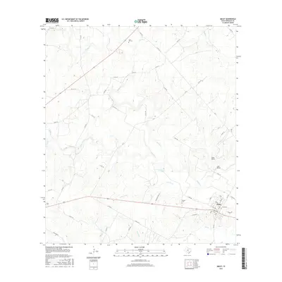
2016 Map of Smiley
USGS Topo · Published 2016About this map
Smiley serves as the primary hub of this south-central Texas landscape, where the confluence of several creek systems defines the topography. The local drainage network is complex, featuring Sandies Cr and its various tributaries including Little Elm Cr, Clear Fork Cr, and Wickey Br. The presence of several historic burial grounds, such as Bundick Cem and Union Hill Cem, offers significant value for genealogical research in this rural portion of Gonzales County. The land is marked by distinct depressions like Evans Hollow and Long Hollow, and the presence of Patterson Lake provides a localized water source. This 2016 survey illustrates a modern road network of Farm-to-Market roads and county lanes that follow the natural rises and falls of the creek-carved terrain, connecting outlying farms to the central settlement.
Find a feature on this map
60 named features on this map. Tap any name to fly to it.
Don’t see what you’re looking for? This feature index may not catch every label — zoom into the map to look around manually.
Map Details
Editions of this 2016 Smiley Map
This is the sole edition of this map. No revisions or reprints were ever made.
Other maps of this area

1920 · Smiley
USGS Topo · 1:125,000

1942 · Dewville
USGS Topo · 1:62,500

1953 · Seguin
USGS Topo · 1:250,000

1956 · Dewville
USGS Topo · 1:62,500

1958 · Seguin
USGS Topo · 1:250,000

1959 · Cost
USGS Topo · 1:24,000

1961 · Sample
USGS Topo · 1:24,000

1961 · Nixon
USGS Topo · 1:24,000
1961 · Pilgrim
USGS Topo · 1:24,000

1961 · Gillett
USGS Topo · 1:24,000