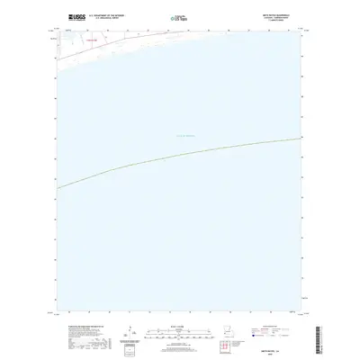
2020 Map of Smith Bayou
USGS Topo · Published 2020About this map
Smith Bayou drains into the coastal marshlands along the northern edge of this Louisiana shoreline, where the land meets the vast expanse of the Gulf of Mexico. Surveyed in the modern era, this map illustrates the low-lying coastal geography of Cameron Parish, characterized by the township boundaries of t15s r14w. The interface between the bayou and the sea provides a clear view of the wetland systems that define this stretch of the Gulf Coast, showing the sparse development and dominance of natural water features in this remote reach of the state.
Find a feature on this map
3 named features on this map. Tap any name to fly to it.
Don’t see what you’re looking for? This feature index may not catch every label — zoom into the map to look around manually.
Map Details
Editions of this 2020 Smith Bayou Map
This is the sole edition of this map. No revisions or reprints were ever made.
Other maps of this area

1932 · Sabine Pass NE
USGS Topo · 1:31,680

1934 · Johnsons Bayou
USGS Topo · 1:24,000

1934 · Peveto Beach
USGS Topo · 1:24,000

1935 · Peveto Beach
USGS Topo · 1:31,680

1935 · Johnsons Bayou
USGS Topo · 1:31,680

1943 · West of Johnson Bayou
USGS Topo · 1:24,000

1944 · Texas Point
USGS Topo · 1:31,680
1946 · Sabine Pass NE
USGS Topo · 1:31,680
1946 · Port Arthur SE
USGS Topo · 1:31,680

1954 · Port Arthur
USGS Topo · 1:250,000