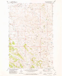
1973 Map of Smith Coulee
USGS Topo · Published 1977About this map
Etchart Cow Camp sits at the base of the Larb Hills in this early 1970s survey of Valley County, Montana. The landscape is defined by an intricate network of drainage channels including Smith Coulee, Cut Throat Coulee, and Shotgun Coulee, which carve through the high plains. This remote ranching country relies heavily on a system of named water sources and ridges to navigate the terrain.
Find a feature on this map
28 named features on this map. Tap any name to fly to it.
Don’t see what you’re looking for? This feature index may not catch every label — zoom into the map to look around manually.
Map Details
Editions of this 1973 Smith Coulee Map
This is the sole edition of this map. No revisions or reprints were ever made.
Other maps of this area

1954 · Jordan
USGS Topo · 1:250,000

1956 · Jordan
USGS Topo · 1:250,000

1958 · Jordan
USGS Topo · 1:250,000

1964 · Jordan
USGS Topo · 1:250,000

1971 · Wolfe Coulee
USGS Topo · 1:24,000

1971 · Wagon Coulee
USGS Topo · 1:24,000
1971 · Swede Ridge
USGS Topo · 1:24,000

1973 · Triple Crossing Reservoir West
USGS Topo · 1:24,000

1973 · Niles Coulee
USGS Topo · 1:24,000
1973 · Gibson Coulee
USGS Topo · 1:24,000