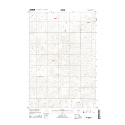
2014 Map of Smith Creek NE
USGS Topo · Published 2014About this map
Wildcat Coulee and the drainage network of the Yellowstone River watershed define this Rosebud County landscape. This part of Montana is characterized by its intermittent waterways and cattle-country infrastructure, where Slaughterhouse Creek Rd and Wildcat Rd provide access through the complex terrain of the northern plains. The map reveals a remote geography shaped by seasonal flow, featuring the forks of W Rosebud Cr and Rosebud Cr alongside Slaughterhouse Cr. These named watercourses, though often dry outside of spring runoff, dictate the placement of ranching routes and property divisions within the township and range survey system. Researchers will find the detailed contours useful for understanding the hydrologic patterns and land use in this sparsely populated region of eastern Montana.
Find a feature on this map
13 named features on this map. Tap any name to fly to it.
Don’t see what you’re looking for? This feature index may not catch every label — zoom into the map to look around manually.
Map Details
Editions of this 2014 Smith Creek NE Map
This is the sole edition of this map. No revisions or reprints were ever made.
Other maps of this area

1954 · Forsyth
USGS Topo · 1:250,000

1957 · Forsyth
USGS Topo · 1:250,000

1958 · Forsyth
USGS Topo · 1:250,000

1968 · Orinoco
USGS Topo · 1:24,000

1968 · Rosebud
USGS Topo · 1:24,000

1968 · Forsyth
USGS Topo · 1:24,000

1971 · Smith Creek NE
USGS Topo · 1:24,000
1971 · Smith Creek
USGS Topo · 1:24,000
1971 · Mc Kerlich Creek
USGS Topo · 1:24,000
1971 · Rosebud Buttes
USGS Topo · 1:24,000