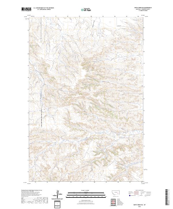
2024 Map of Smith Creek NE
USGS Topo · Published 2024About this map
West Rosebud Creek and West Vance Creek weave through this section of Rosebud County, where the landscape is defined by its dramatic drainage patterns. The township and range lines of t6n r41e and t5n r42e mark out a territory primarily shaped by seasonal waterways like Wildcat Coulee and the starkly named Slaughterhouse Creek. This survey captures the sparse infrastructure of the region, anchored by the lone passage of Wildcat Rd in the north. The absence of established settlements or extensive road networks underscores the rural, open-range character of this part of Montana, where the primary topographic interest lies in the complex system of coulees and creek beds that channel the area's occasional runoff toward the Rosebud drainage system.
Find a feature on this map
11 named features on this map. Tap any name to fly to it.
Don’t see what you’re looking for? This feature index may not catch every label — zoom into the map to look around manually.
Map Details
Editions of this 2024 Smith Creek NE Map
This is the sole edition of this map. No revisions or reprints were ever made.
Other maps of this area

1954 · Forsyth
USGS Topo · 1:250,000

1957 · Forsyth
USGS Topo · 1:250,000

1958 · Forsyth
USGS Topo · 1:250,000

1968 · Orinoco
USGS Topo · 1:24,000

1968 · Rosebud
USGS Topo · 1:24,000

1968 · Forsyth
USGS Topo · 1:24,000

1971 · Smith Creek NE
USGS Topo · 1:24,000
1971 · Smith Creek
USGS Topo · 1:24,000
1971 · Mc Kerlich Creek
USGS Topo · 1:24,000
1971 · Rosebud Buttes
USGS Topo · 1:24,000