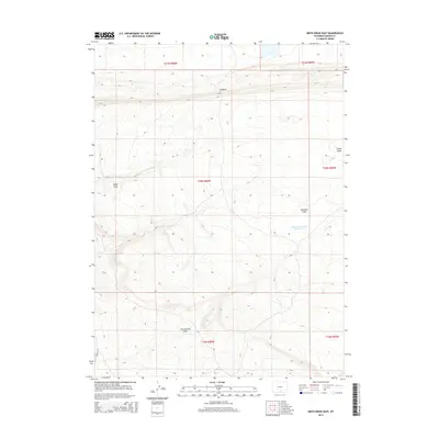
2015 Map of Smith Draw East
USGS Topo · Published 2015About this map
Johnston Number 2 Reservoir provides a primary point of water management in this arid stretch of Carbon County, where the landscape is defined by extensive drainage systems and dramatic elevation shifts. The terrain transitions from the low-lying Severson Flats toward the prominent Hogback ridge that cuts across the northern reaches of the quadrangle. These natural corridors, including Smith Draw and Hugus Draw, dictate the movement of water and livestock through the high plains. In the southwest corner, the topography becomes more severe at Hugus Cliff, overlooking the headwaters of Iron Springs Draw. This 2015 survey reflects a landscape largely shaped by seasonal water flow and the demands of open-country ranching, offering a look at the geographic features that have influenced land use in this part of Wyoming for generations.
Find a feature on this map
13 named features on this map. Tap any name to fly to it.
Don’t see what you’re looking for? This feature index may not catch every label — zoom into the map to look around manually.
Map Details
Editions of this 2015 Smith Draw East Map
This is the sole edition of this map. No revisions or reprints were ever made.
Other maps of this area

1893 · Fort Steele
USGS Topo · 1:125,000

1914 · Walcott
USGS Topo · 1:62,500

1953 · Sinclair
USGS Topo · 1:24,000

1953 · Rawlins
USGS Topo · 1:24,000

1954 · Rawlins
USGS Topo · 1:250,000

1955 · Overland Crossing
USGS Topo · 1:24,000

1955 · Savage Ranch
USGS Topo · 1:24,000

1956 · Bolten Ranch
USGS Topo · 1:62,500

1958 · Rawlins
USGS Topo · 1:250,000

1962 · Rawlins
USGS Topo · 1:250,000