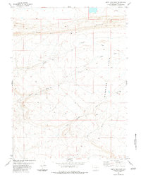
1983 Map of Smith Draw East
USGS Topo · Published 1983About this map
Hogback and the high desert plains of Carbon County define this landscape as it was documented in the late 1970s and early 1980s. The area is characterized by a series of intermittent drainages and elevated plateaus, most notably Severson Flats and the distinctive Iron Mess. These geological formations dictated the movement of both water and commerce in this arid environment, evidenced by the network of Springs and named ephemeral watercourses like Smith Draw and Hugus Draw.
Find a feature on this map
10 named features on this map. Tap any name to fly to it.
Don’t see what you’re looking for? This feature index may not catch every label — zoom into the map to look around manually.
Map Details
Editions of this 1983 Smith Draw East Map
This is the sole edition of this map. No revisions or reprints were ever made.
Other maps of this area

1893 · Fort Steele
USGS Topo · 1:125,000

1914 · Walcott
USGS Topo · 1:62,500

1953 · Sinclair
USGS Topo · 1:24,000

1953 · Rawlins
USGS Topo · 1:24,000

1954 · Rawlins
USGS Topo · 1:250,000

1955 · Overland Crossing
USGS Topo · 1:24,000

1955 · Savage Ranch
USGS Topo · 1:24,000

1956 · Bolten Ranch
USGS Topo · 1:62,500

1958 · Rawlins
USGS Topo · 1:250,000

1962 · Rawlins
USGS Topo · 1:250,000