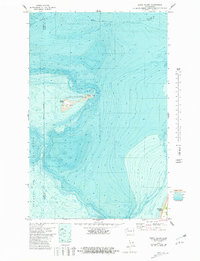
1978 Map of Smith Island
USGS Topo · Published 1981About this map
Smith Island and Minor Island anchor this hydrographic study of the marine environment at the eastern end of the Strait of Juan de Fuca. Part of the San Juan Islands National Wildlife Refuge, these low-lying landforms are surrounded by the submerged topography of the Partridge Bank. The map records specific navigational and survival landmarks on Smith Island, including a Cistern, a Light, and a benchmark noted as BM 16.
Find a feature on this map
15 named features on this map. Tap any name to fly to it.
Don’t see what you’re looking for? This feature index may not catch every label — zoom into the map to look around manually.
Map Details
Editions of this 1978 Smith Island Map
This is the sole edition of this map. No revisions or reprints were ever made.
Other maps of this area

1939 · Port Townsend
USGS Topo · 1:62,500

1939 · Coupeville
USGS Topo · 1:62,500

1943 · Richardson
USGS Topo · 1:62,500

1943 · Deception Pass
USGS Topo · 1:62,500

1951 · Deception Pass
USGS Topo · 1:62,500

1953 · Coupeville
USGS Topo · 1:24,000

1953 · Port Townsend North
USGS Topo · 1:24,000

1957 · Richardson
USGS Topo · 1:62,500

1957 · Victoria
USGS Topo · 1:250,000
1973 · Lopez Pass
USGS Topo · 1:24,000