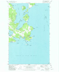
1973 Map of Lopez Pass
USGS Topo · Published 1977About this map
Lopez Island and Decatur Island define this coastal landscape where the Strait of Juan de Fuca meets the Rosario Strait. The intricate coastline is marked by deep inlets like Hunter Bay, Mackaye Harbor, and Watmough Bay, revealing a maritime environment of reefs and rocky outcroppings. Small landmasses such as Center Island, Ram Island, and Colville Island are scattered throughout Lopez Sound, several of which are protected as part of the San Juan Islands National Wildlife Refuge. On shore, the terrain rises to notable heights at Chadwick Hill, overlooking Watmough Head and the narrow passage of Lopez Pass. The presence of Gravel Pits and various light-duty roads like Pavey Blvd suggests a mix of local industry and recreational access, including sites like Agate Beach County Park and Castle Island State Park.
Find a feature on this map
49 named features on this map. Tap any name to fly to it.
Don’t see what you’re looking for? This feature index may not catch every label — zoom into the map to look around manually.
Map Details
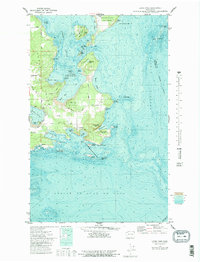
Editions of this 1973 Lopez Pass Map
2 editions found
Other maps of this area

1943 · Richardson
USGS Topo · 1:62,500

1943 · Orcas Island
USGS Topo · 1:62,500

1943 · Deception Pass
USGS Topo · 1:62,500

1943 · Anacortes
USGS Topo · 1:62,500

1951 · Deception Pass
USGS Topo · 1:62,500

1951 · Anacortes
USGS Topo · 1:62,500

1957 · Richardson
USGS Topo · 1:62,500

1957 · Orcas Island
USGS Topo · 1:62,500

1957 · Victoria
USGS Topo · 1:250,000

1973 · Cypress Island
USGS Topo · 1:24,000