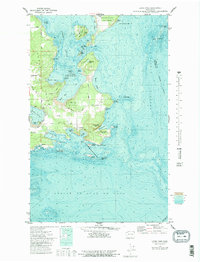
1973 Map of Lopez Pass
USGS Topo · Published 1981About this map
Lopez Island and Decatur Island anchor this hydrographic and topographic study of the San Juan archipelago. In the early 1970s, the landscape shows a mix of protected conservation areas and early development, including the San Juan Islands National Wildlife Refuge protecting small landforms like Crab Island and Skull Island. Transportation is represented by a Landing Strip on Decatur Island and the corridor of Pavey Blvd on the larger Lopez Island landmass.
Find a feature on this map
51 named features on this map. Tap any name to fly to it.
Don’t see what you’re looking for? This feature index may not catch every label — zoom into the map to look around manually.
Map Details
Editions of this 1973 Lopez Pass Map
2 editions found
Other maps of this area

1943 · Richardson
USGS Topo · 1:62,500

1943 · Orcas Island
USGS Topo · 1:62,500

1943 · Deception Pass
USGS Topo · 1:62,500

1943 · Anacortes
USGS Topo · 1:62,500

1951 · Deception Pass
USGS Topo · 1:62,500

1951 · Anacortes
USGS Topo · 1:62,500

1957 · Richardson
USGS Topo · 1:62,500

1957 · Orcas Island
USGS Topo · 1:62,500

1957 · Victoria
USGS Topo · 1:250,000

1973 · Cypress Island
USGS Topo · 1:24,000