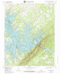
1967 Map of Smith Mountain Dam
USGS Topo · Published 1984About this map
Smith Mountain Dam anchors this mid-century landscape where the Roanoke River and Blackwater River converge to form the sprawling Smith Mountain Lake. This survey captures the region during a period of transition, following the creation of the reservoir which reshaped the geography of Bedford, Franklin, and Pittsylvania Counties. The map details the intricate shoreline of the lake and its many inlets, such as Craddock Creek and Witcher Creek, while also showing Leesville Lake downstream. Settlement patterns are concentrated around rural hubs like Dundee, Kasey, and Graves Store. Local heritage is preserved through the locations of numerous family cemeteries and country churches, including Patmos Ch and Thomas Chapel. Steep terrain features like Smith Mountain and Broad Ridge tower over the water, defining the physical boundary between the three counties.
Find a feature on this map
43 named features on this map. Tap any name to fly to it.
Don’t see what you’re looking for? This feature index may not catch every label — zoom into the map to look around manually.
Map Details
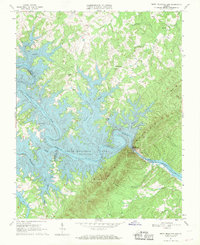
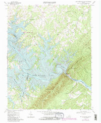
Editions of this 1967 Smith Mountain Dam Map
Other maps of this area

1890 · Roanoke
USGS Topo · 1:125,000

1891 · Roanoke
USGS Topo · 1:125,000

1892 · Lynchburg
USGS Topo · 1:125,000

1921 · Chatham
USGS Topo · 1:48,000

1922 · Callands
USGS Topo · 1:48,000

1923 · Chatham
USGS Topo · 1:62,500

1924 · Callands
USGS Topo · 1:62,500

1944 · Callands
USGS Topo · 1:62,500

1947 · Roanoke
USGS Topo · 1:250,000

1951 · Moneta
USGS Topo · 1:62,500