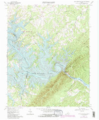
1967 Map of Smith Mountain Dam
USGS Topo · Published 1984About this map
Smith Mountain and the Gap of Smith Mtn dominate this 1967 landscape, captured during a period of significant hydroelectric development. The massive Smith Mountain Lake dominates the central terrain, reaching its normal pool elevation of 795 feet, while downstream, Leesville Lake sits at an elevation of 604 feet. This survey details the complex shoreline formed by flooded drainages like Craddock Creek, Witcher Creek, and the Blackwater River.
Find a feature on this map
44 named features on this map. Tap any name to fly to it.
Don’t see what you’re looking for? This feature index may not catch every label — zoom into the map to look around manually.
Map Details
Editions of this 1967 Smith Mountain Dam Map
Other maps of this area

1890 · Roanoke
USGS Topo · 1:125,000

1891 · Roanoke
USGS Topo · 1:125,000

1892 · Lynchburg
USGS Topo · 1:125,000

1921 · Chatham
USGS Topo · 1:48,000

1922 · Callands
USGS Topo · 1:48,000

1923 · Chatham
USGS Topo · 1:62,500

1924 · Callands
USGS Topo · 1:62,500

1944 · Callands
USGS Topo · 1:62,500

1947 · Roanoke
USGS Topo · 1:250,000

1951 · Moneta
USGS Topo · 1:62,500