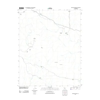
2012 Map of Smith Mountain
USGS Topo · Published 2012About this map
Warthan Cr carves a deep diagonal path through this arid Fresno County landscape, joined by a network of drainage systems like Sulphur Cr and Jacalitos Cr. The terrain is defined by its canyons and high points, most notably Smith Mountain and the distinct formation known as The Pinnacles. Genealogists and local historians will find the Warthan Cem located near the intersection of Warthan Cr and S Coalinga Mineral Springs Rd, serving as a silent marker of early settlement in this remote interior. Several natural springs, including Sulphur Spring and Iron Spring, dot the landscape, suggesting the historical importance of water sources for cattle and transit through valleys like Bourdieu Valley and Hidden Valley. The area remains sparsely developed, with winding routes such as Slacks Canyon Rd following the natural contours of the steep ridges.
Find a feature on this map
36 named features on this map. Tap any name to fly to it.
Don’t see what you’re looking for? This feature index may not catch every label — zoom into the map to look around manually.
Map Details
Editions of this 2012 Smith Mountain Map
This is the sole edition of this map. No revisions or reprints were ever made.
Other maps of this area

1912 · Coalinga
USGS Topo · 1:125,000

1914 · Cholame
USGS Topo · 1:125,000

1915 · Priest Valley
USGS Topo · 1:125,000

1915 · Cholame
USGS Topo · 1:125,000

1917 · Cholame
USGS Topo · 1:125,000

1919 · San Miguel
USGS Topo · 1:62,500

1941 · Priest Valley
USGS Topo · 1:62,500

1942 · Parkfield
USGS Topo · 1:24,000
1943 · Parkfield
USGS Topo · 1:31,680
1944 · Coalinga
USGS Topo · 1:62,500