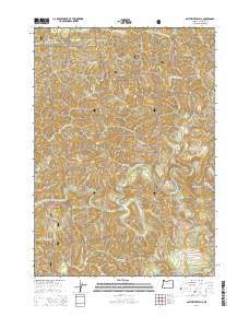
2014 Map of Smith River Falls
USGS Topo · Published 2014About this map
Siuslaw National Forest encompasses the majority of this Oregon coastal range landscape, defined by a complex network of drainage basins and high ridges. The Smith River serves as the central artery, fed by numerous tributaries including Rachel Cr and Wasson Cr. Significant elevation changes are visible at Wasson Ridge and a unique landform identified as The Island. The mapping reflects a region managed for timber and conservation, dominated by a grid of Bureau of Land Management and National Forest roads such as Nat For Dev Rd 2313 and BLM 15 3. At the heart of the hydrography is Smith River Falls, a notable natural landmark on the river's course. The density of named creeks like Fisher Cr and Bear Cr illustrates the intricate watershed geography that characterizes this part of Douglas County.
Find a feature on this map
48 named features on this map. Tap any name to fly to it.
Don’t see what you’re looking for? This feature index may not catch every label — zoom into the map to look around manually.
Map Details
Editions of this 2014 Smith River Falls Map
This is the sole edition of this map. No revisions or reprints were ever made.
Other maps of this area

1919 · Earl
USGS Topo · 1:48,000

1942 · Roman Nose Mtn
USGS Topo · 1:62,500

1943 · Goodwin Peak
USGS Topo · 1:62,500

1945 · Roman Nose Mtn
USGS Topo · 1:62,500

1955 · Scottsburg
USGS Topo · 1:62,500

1955 · Elkton
USGS Topo · 1:62,500
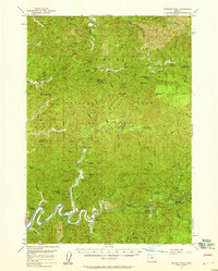
1956 · Goodwin Peak
USGS Topo · 1:62,500

1958 · Roseburg
USGS Topo · 1:250,000

1959 · Roseburg
USGS Topo · 1:250,000

1979 · Cottage Grove
USGS Topo · 1:100,000