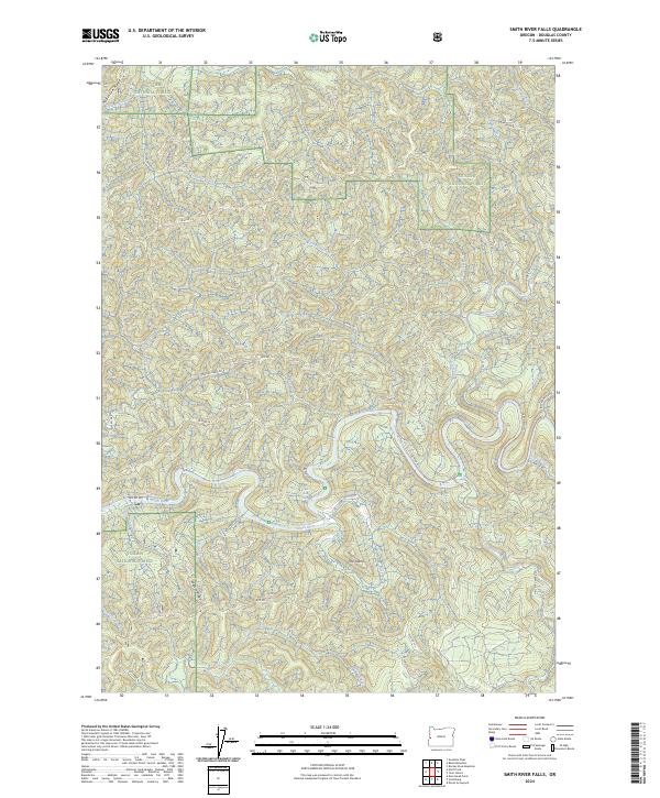
2024 Map of Smith River Falls
USGS Topo · Published 2024About this map
Smith River Falls serves as a central landmark in this densely forested region of Douglas County, where the Smith River winds through steep, timbered canyons. Much of the landscape is protected within the Siuslaw National Forest, showing a modern conservation footprint that includes the Devil's Staircase Wilderness and the Wasson Wild and Scenic River. The map reveals a complex network of Bureau of Land Management routes, such as Spencer Creek Rd and Vincent Creek Rd, which provide access to the area's many tributaries including Johnson Creek and Wasson Creek. Notable terrain features like The Island and Wasson Ridge illustrate the deep erosion patterns of the river system. This survey documents the intersection of active forest management roads with pristine wilderness areas, tracing the paths of the West Fork Smith River as it joins the main channel.
Find a feature on this map
45 named features on this map. Tap any name to fly to it.
Don’t see what you’re looking for? This feature index may not catch every label — zoom into the map to look around manually.
Map Details
Editions of this 2024 Smith River Falls Map
This is the sole edition of this map. No revisions or reprints were ever made.
Other maps of this area

1919 · Earl
USGS Topo · 1:48,000

1942 · Roman Nose Mtn
USGS Topo · 1:62,500

1943 · Goodwin Peak
USGS Topo · 1:62,500

1945 · Roman Nose Mtn
USGS Topo · 1:62,500

1955 · Scottsburg
USGS Topo · 1:62,500

1955 · Elkton
USGS Topo · 1:62,500
1956 · Goodwin Peak
USGS Topo · 1:62,500

1958 · Roseburg
USGS Topo · 1:250,000

1959 · Roseburg
USGS Topo · 1:250,000

1979 · Cottage Grove
USGS Topo · 1:100,000