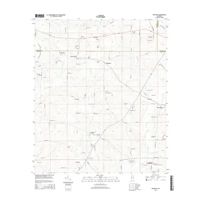
2015 Map of Smithdale
USGS Topo · Published 2015About this map
Smithdale and Hustler anchor this rural landscape in Amite County, where the terrain is defined by the headwaters of the W Fork Amite River and E Fork Amite River. The settlement pattern is deeply connected to family-named landmarks and a high density of rural cemeteries, reflecting a long-established community structure. These sites, such as Westbrook Memorial Cem and the Old Good Hope Cem, are scattered across the township lines near the Franklin and Lincoln County borders. This 2015 survey reveals how the local road network, including Fenn Rd and Branch Rd, navigates the many small tributaries like Pumpkin Patch Cr and Shackaloa Cr. The map illustrates a quiet region of Southwest Mississippi where small unincorporated communities like Mars Hill and Thompson remain tied to the land and its winding waterways.
Find a feature on this map
145 named features on this map. Tap any name to fly to it.
Don’t see what you’re looking for? This feature index may not catch every label — zoom into the map to look around manually.
Map Details
Editions of this 2015 Smithdale Map
This is the sole edition of this map. No revisions or reprints were ever made.
Other maps of this area

1953 · Natchez
USGS Topo · 1:250,000

1956 · Natchez
USGS Topo · 1:250,000

1959 · Natchez
USGS Topo · 1:250,000

1961 · Liberty
USGS Topo · 1:62,500

1962 · Bude
USGS Topo · 1:62,500

1972 · West Lincoln
USGS Topo · 1:24,000

1972 · Smithdale
USGS Topo · 1:24,000

1972 · Little Springs
USGS Topo · 1:24,000

1972 · Auburn
USGS Topo · 1:24,000

1972 · Peoria
USGS Topo · 1:24,000