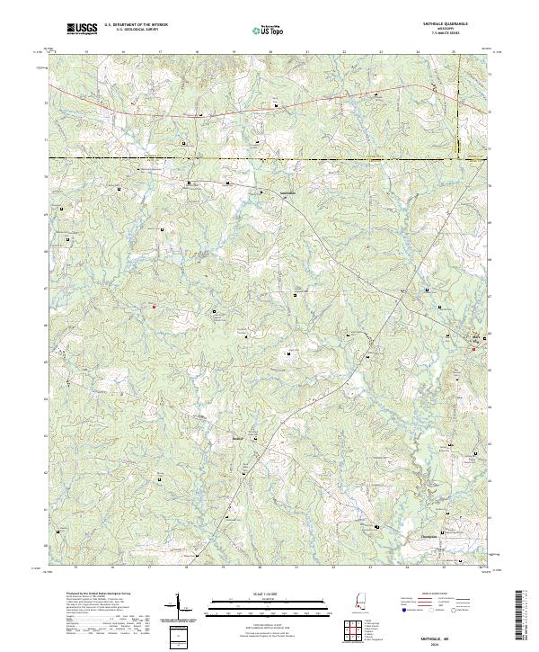
2024 Map of Smithdale
USGS Topo · Published 2024About this map
The borderlands of Franklin and Amite Counties define this rural landscape, where the community of Smithdale serves as a central hub. The area is characterized by a dense network of family and community burial grounds, such as the Wroten and Carraway Cem and Temple Hill Cem, which offer significant value for genealogical research. Settlement patterns follow the winding paths of local waterways like Westbrook Creek and Shackaloa Creek, with small clusters of activity at Hustler and Thompson. Spiritual life is anchored by historic congregations, including Oak Grove Baptist Church and Spring Hill Baptist Church. The presence of labels like Starvation Plantation Rd and numerous family-named roads indicates a landscape deeply tied to its agricultural and land-ownership history, persisting into the modern era.
Find a feature on this map
106 named features on this map. Tap any name to fly to it.
Don’t see what you’re looking for? This feature index may not catch every label — zoom into the map to look around manually.
Map Details
Editions of this 2024 Smithdale Map
This is the sole edition of this map. No revisions or reprints were ever made.
Other maps of this area

1953 · Natchez
USGS Topo · 1:250,000

1956 · Natchez
USGS Topo · 1:250,000

1959 · Natchez
USGS Topo · 1:250,000

1961 · Liberty
USGS Topo · 1:62,500

1962 · Bude
USGS Topo · 1:62,500

1972 · West Lincoln
USGS Topo · 1:24,000

1972 · Smithdale
USGS Topo · 1:24,000

1972 · Little Springs
USGS Topo · 1:24,000

1972 · Auburn
USGS Topo · 1:24,000

1972 · Peoria
USGS Topo · 1:24,000